EnergyCare is now in a stronger financial position and is helping more and more vulnerable people in St. Louis thanks to supporters …
EnergyCare is now in a stronger financial position and is helping more and more vulnerable people in St. Louis thanks to supporters …
Please join us for a happy hour and light snacks on Thursday, September 14, at 4:00-6:00 pm Parish Rectory Community Room …
Jana Ngugi has been serving with EnergyCare for 16 years now and is a valuable team member. Jana graduated from University of …
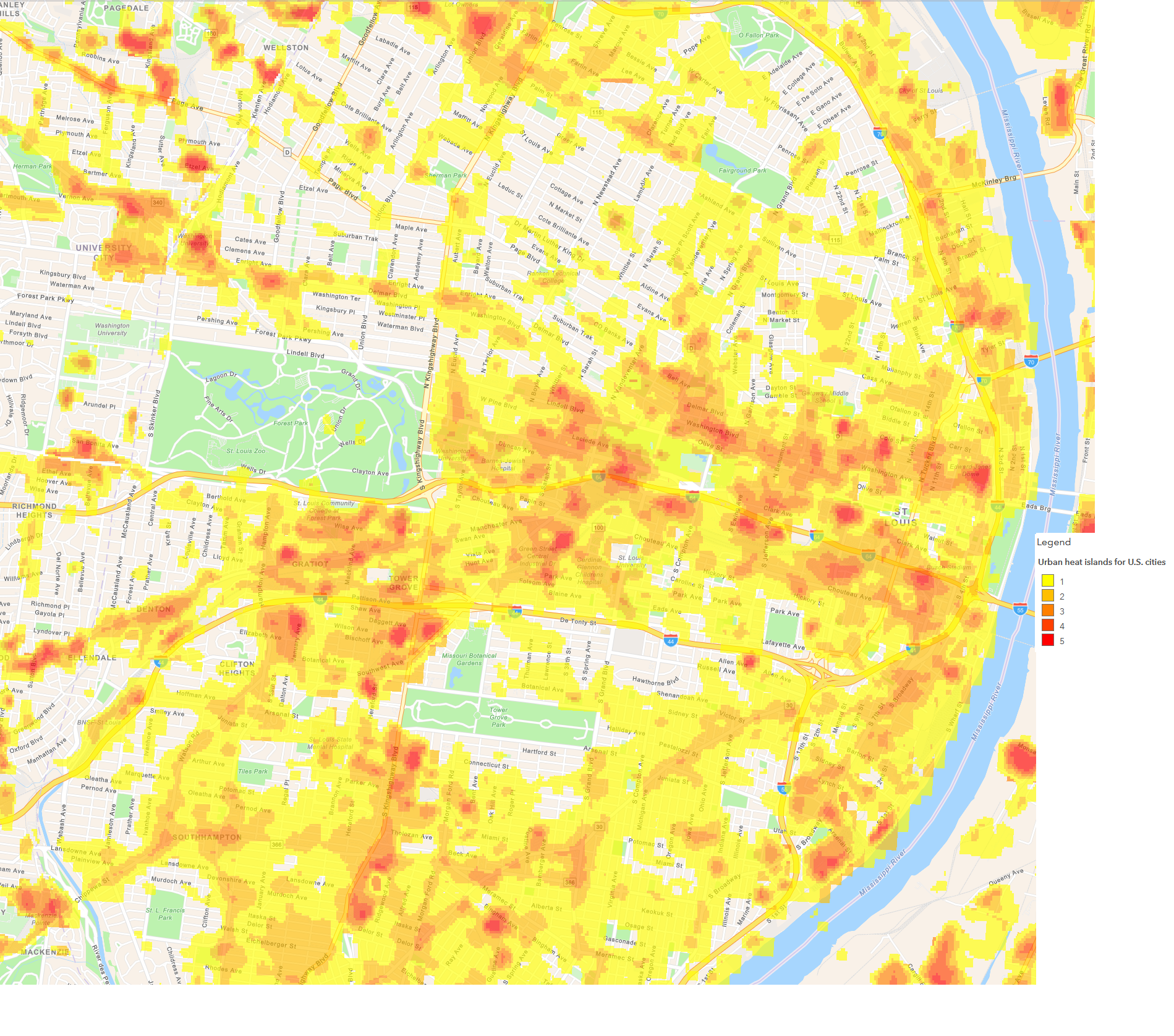
A study published by the American Heart Association has found the combination of extreme heat and fine particulate pollution (air pollution from …
